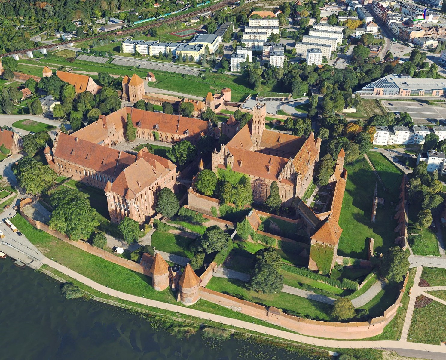
3D mesh models are three-dimensional visualizations of objects covered with image textures from oblique aerial imagery. The model is created by applying algorithms for automatically matching common points on all images – both oblique and vertical, using data from laser scanning.
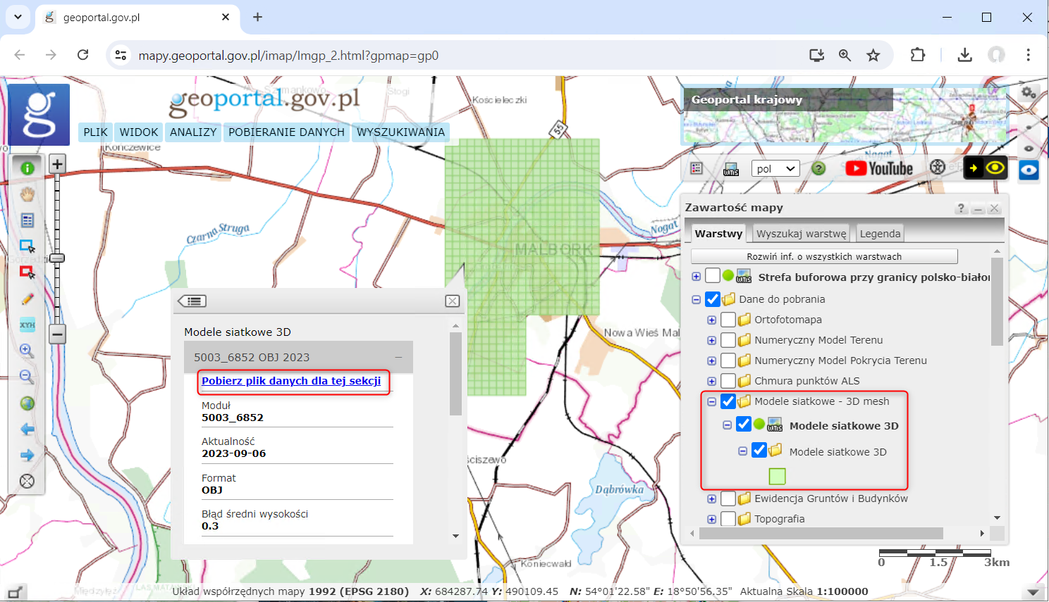
3D mesh models can be downloaded for free using the index maps available on the service www.geoportal.gov.pl in group of layers „Data for download”:
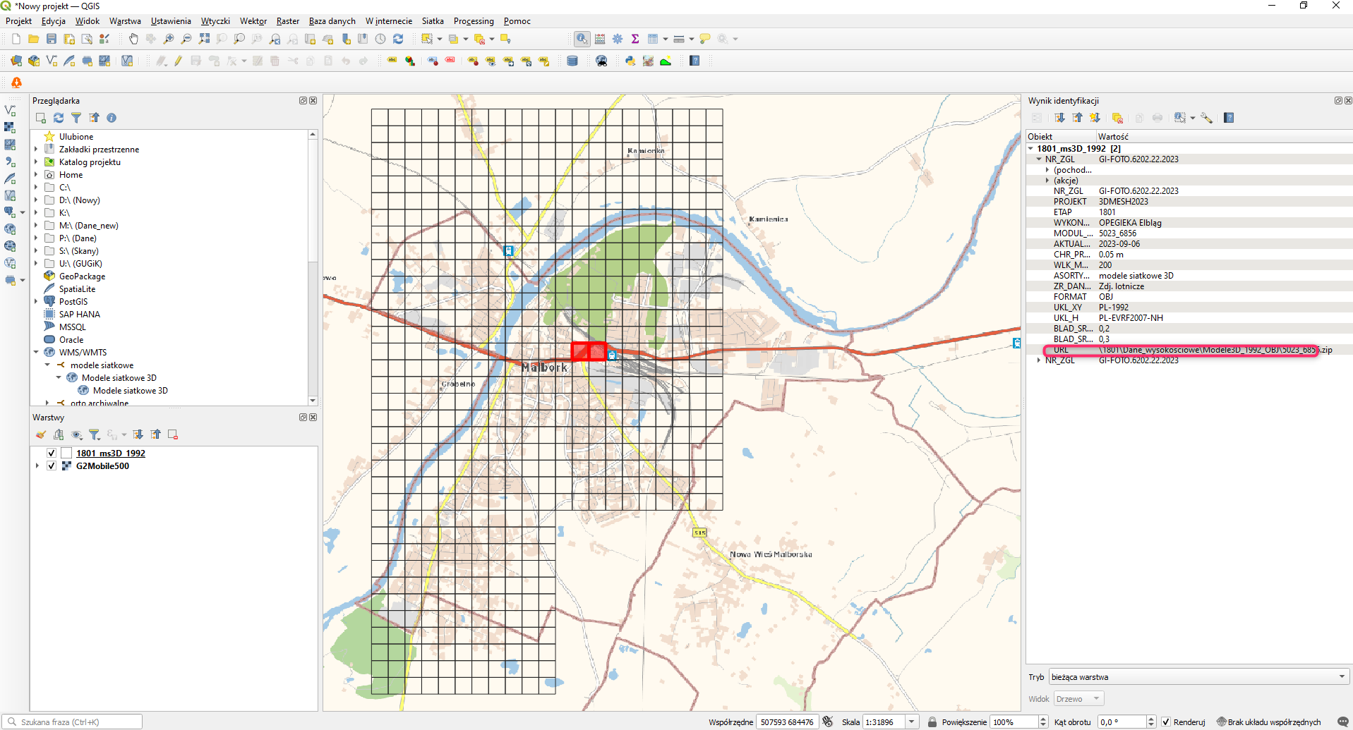
An alternative way to download data is by connecting to the WMS service available at the address: https://mapy.geoportal.gov.pl/wss/service/PZGIK/NMT/WMS/ModeleSiatkowe3D in opensource software e.g. QGIS.