Topographic maps
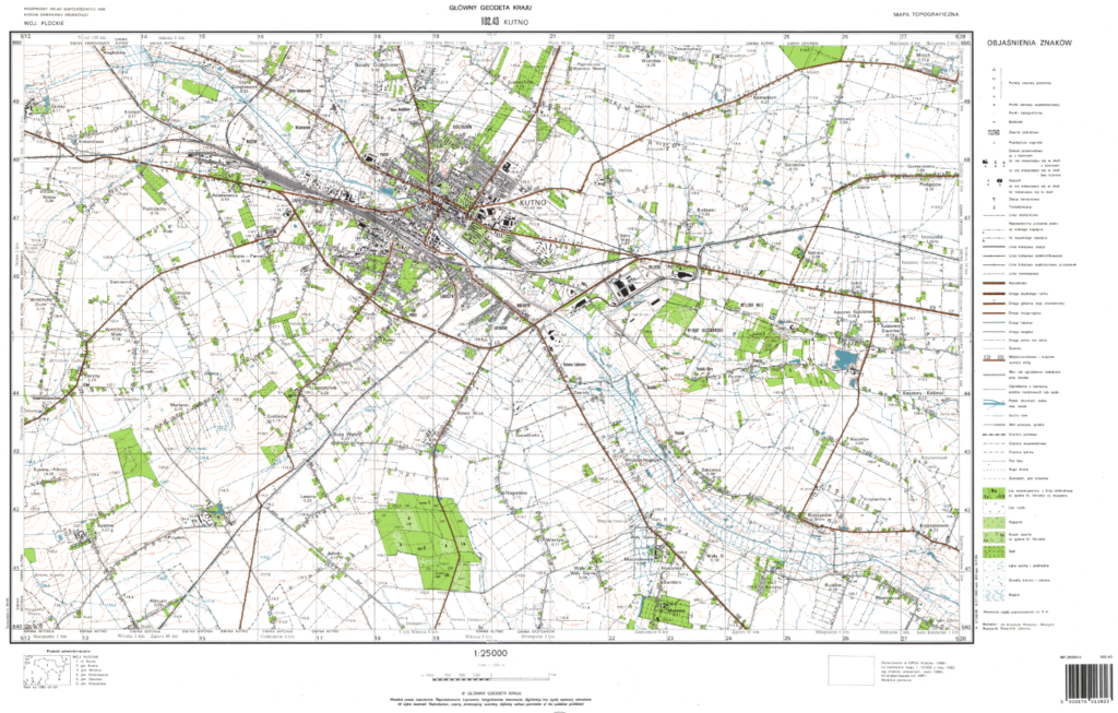
A topographic map is a cartographic representation of general-purpose geographic content, especially topographic objects and features, at scales from 1:10,000 to 1:100,000. Standards for the development of topographic maps are specified by the Regulation of the Minister of Development, Labour and Technology of 27 July 2021 on the topographic objects database and the database of general geographical objects, as well as standard cartographic studies. Topographic maps are designed to meet a variety of economic needs, including, without limitation, the need to perform geodetic and cartographic calculations, to prepare and implement spatial development plans, to solve scientific and research problems, to study the terrain and assess its specificity, to provide a base map for the development of thematic maps, to provide a base for crisis management purposes, military purposes, for tourism, or for archeology. Topographic maps reflect the condition of the terrain, its typical features and characteristics in a reliable manner and with a detail appropriate to the scale. The picture of the terrain is presented by means of conventional graphic symbols in accordance with map compilation rules.
Topographic maps available at the central level of the National Geodetic and Cartographic Resources (hereinafter referred to as “NGCR”) have been developed in line with previously applicable regulations, based on field measurements, photogrammetric methods, or combined methods. They are available at the scales of 1:10,000, 1:25,000, 1:50,000 and 1:100,000 and made in the “1942”, “1965”, “1992” , “GUGiK 80” and “WGS-84” coordinate systems. Topographic maps are made available in the form of raster files (map scans) in tiff or geotiff format, or in print.
General geographic maps
General geographic maps represent basic geographical features and phenomena. Standards for the development of general geographic maps are specified by the Regulation of the Minister of Development, Labour and Technology on the topographic objects database and the database of general geographical objects, as well as standard cartographic studies.
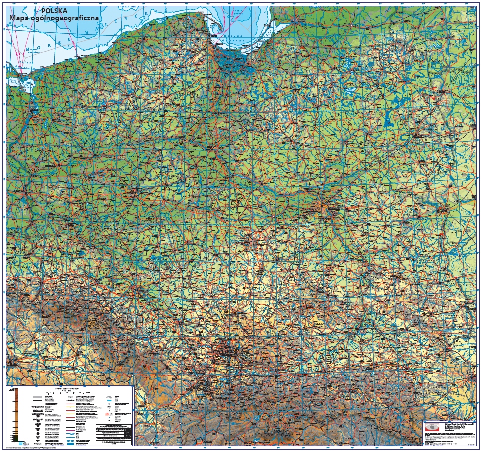
General geographic maps available in the NGCR are general maps at the scales of 1:250,000, 1:500,000, 1:1,000,000 and 1:4,000,000. General geographic maps were created on the basis of the general geographical database which includes data collected with a level of detail corresponding to the scale of 1:250,000. Data from this database has been generalized and aggregated to prepare databases with levels of detail corresponding to the scales of 1:500,000, 1:1,000,000 and 1:4,000,000, and then to develop general geographic maps.
General geographic maps are available as vector maps in PostScript (*.eps) format and as raster maps in .jpg format. General geographic databases used to develop these maps are shared in Shapefile (*.shp) format.
In 2011, a general geographic map at the scale of 1:500,000 (Fig. 2) commissioned by the Head Office of Geodesy and Cartography (GUGiK) was developed. The map was developed in a cylindrical, transversal, equiangular Gauss-Kruger projection with meridian 19° east of Greenwich, in the “1992” flat rectangular coordinate system. The map is shared in digital version in PostScript vector format (*.eps) or raster PDF format.
Thematic maps
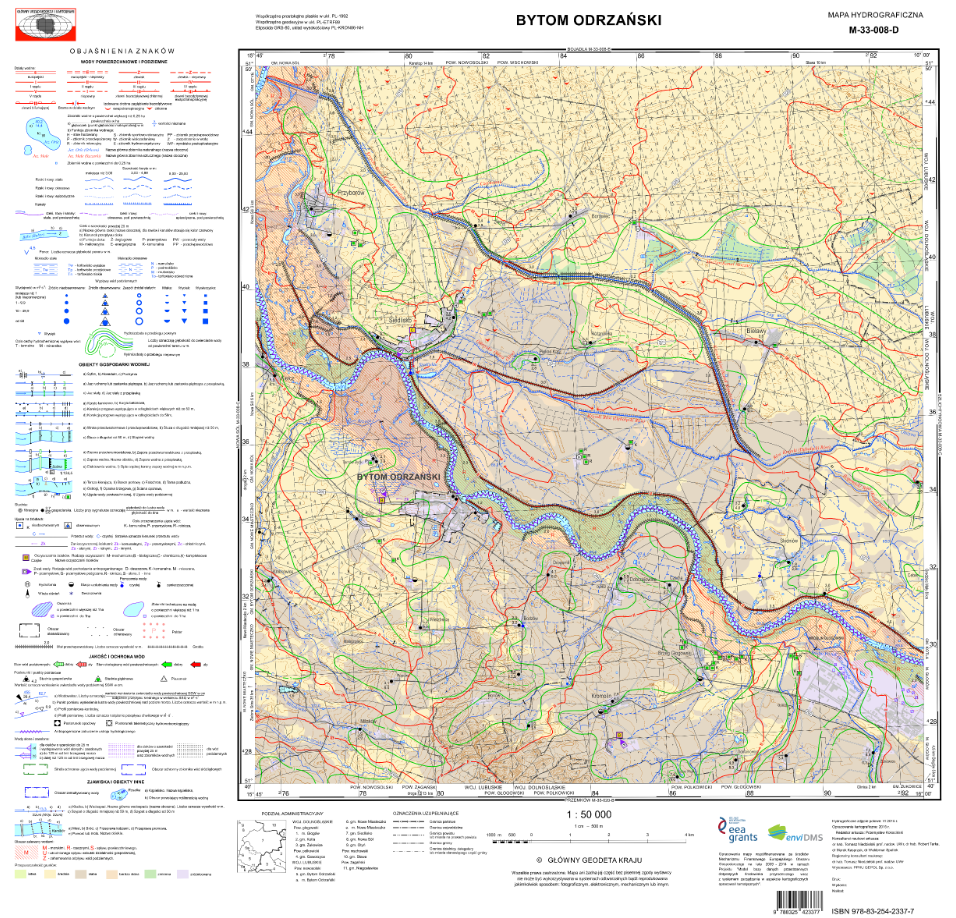
The Hydrographic Map of Poland shared at the NGCR shows the instantaneous state and conditions of the water cycle during the mapping period in relation to the geographical environment. This map was developed on the basis of a topographic map at the scale of 1:50,000 in the following flat rectangular coordinate systems: “PL-1942”, “PL- 1965” and “PL-1992”. The content of the map is supplemented by comments at the back of the map. Comments to the hydrographic map include general natural characteristics of the area represented on the sheet and, among other things, characteristics of precipitation, surface and underground waters with particular emphasis on their pollution, and transformations of hydrographic conditions.
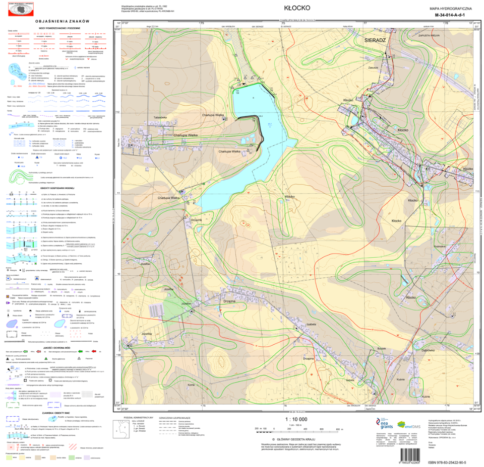
Hydrographic maps collected at the NGCR are shared in TAB format with comments to the “PL-1942” system, and in TAB and shapefile (SHP) format with comments to the “PL-1992” coordinate system.
The EnviDMS project included the development of several dozen hydrographic map sheets at the scale of 1:10,000 and several hundred sheets at the scale of 1:50,000 in the “PL-1992” coordinate system. These maps are shared in shapefile, mdb, and gml formats – depending on the sheet.
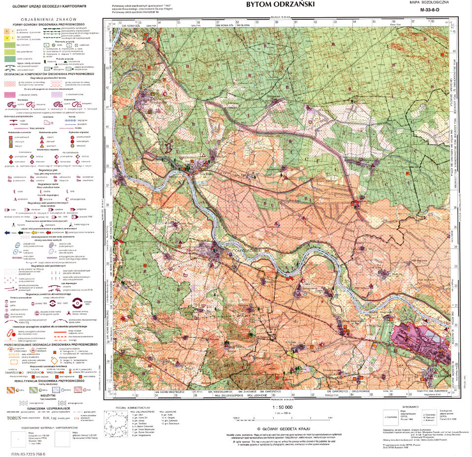
The Sozological Map of Poland is a map that shows the condition of the natural environment, as well as the causes and effects of transformations taking place in the environment under the influence of various processes. It also shows the ways of protecting the natural values of this environment. This map was developed on the basis of a topographic map at the scale of 1:50,000 in the following flat rectangular coordinate systems: “PL-1942” and “PL-1992”. The content of the map is supplemented by comments at the back of the map. Comments to the sozological map also include, among other things, information on threats to and degradation of surface and underground waters, a general assessment of the condition of the environment, and indications for its development and protection.
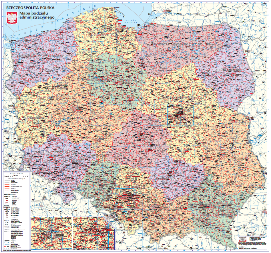
The Administrative Map of Poland represents administrative borders of voivodships, counties and cities with county rights, borders of communes, cities within communes, and borders of Warsaw districts. The map was developed in the “PL-1992” flat rectangular coordinate system at the scale of 1:500,000, in a cylindrical, transversal, equiangular Gauss-Kruger projection with meridian 19° east of Greenwich.
The Landscape Map of Poland represents administrative borders, settlements, road network, railroads, marine ferry routes, hydrographic features, borders of national and landscape parks, shading, mountain passes, rocks, caves, airports, seaports, junctions on highways and dual carriageways, nomenclature, forest areas, primeval forests, islands, peninsulas, capes, high points, passes, border crossings, national parks, and landscape parks. The map was developed in the “PL-1992” flat rectangular coordinate system at the scale of 1:500,000, in a cylindrical, transversal, equiangular Gauss PL-1992 Kruger projection with meridian 19° east of Greenwich.
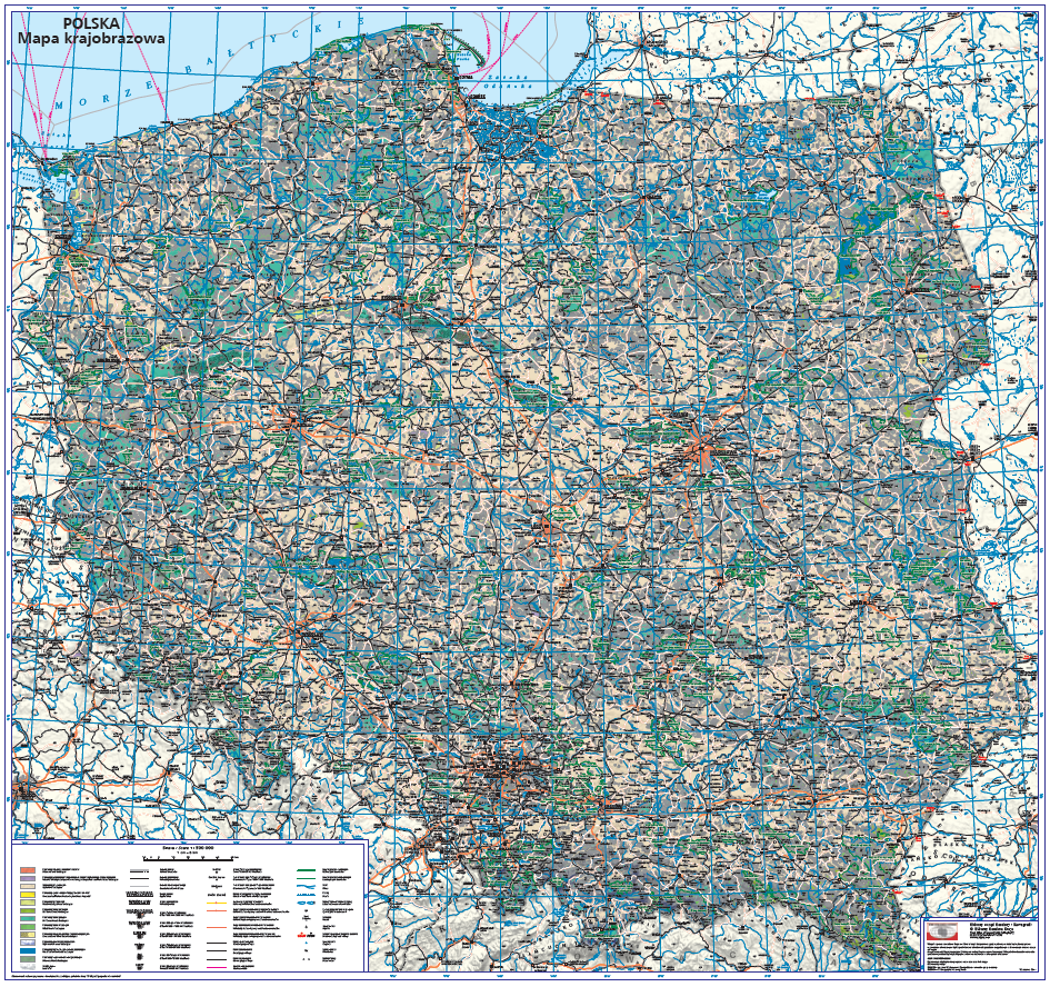
Administrative and landscape maps are shared in PostScript vector format (*.eps) or raster PDF format.
The Soil and agricultural map represents the spatial variability of soil sites and provides information on major physical properties and agricultural usefulness of soil. The soil and agricultural maps available in NGCR are developed at the scale of 1:5,000, in vector format in PL-1992 (EPSG: 2180) coordinate system and they cover the areas of the:
- Dolnośląskie Voivodship (GML data developed on the basis of data from the voivodeship geodetic and cartographic documentation centre, supplemented by GUGiK’s own work),
- Kujawsko-Pomorskie Voivodship (GML data developed on the basis of vector data from the voivodeship geodetic and cartographic documentation centre and county geodetic and cartographic documentation centres as well as GUGiK’s own and commissioned works),
- part of Lubelskie Voivodship (GML data developed on the basis of vector data from the voivodeship geodetic and cartographic documentation centre and county geodetic and cartographic documentation centres as well as GUGiK’s own and commissioned works),
- Lubuskie Voivodship (GML data developed on the basis of vector data from the voivodeship geodetic and cartographic documentation centre),
- Łódzkie Voivodship (GML data developed on the basis of vector data from the voivodeship geodetic and cartographic documentation centre),
- Małopolskie Voivodeship (GML data developed on the basis of vector data from the voivodeship geodetic and cartographic documentation centre),
- Mazowieckie Voivodship (GML data developed as GUGiK’s commissioned works),
- Opolskie Voivodship (GML data developed as GUGiK’s commissioned works),
- Podkarpackie Voivodship (GML data developed on the basis of vector data from the voivodeship geodetic and cartographic documentation centre),
- Podlaskie Voivodship (GML data developed on the basis of vector data from the voivodeship geodetic and cartographic documentation centre),
- part of Pomorskie Voivodship (GML data developed on the basis of data from the voivodeship geodetic and cartographic documentation centre, supplemented by GUGiK’s own work),
- Śląskie Voivodship (GML data developed on the basis of vector data from the voivodeship geodetic and cartographic documentation centre and GUGiK’s commissioned works),
- Świętokrzyskie Voivodship (GML data developed on the basis of vector data from the voivodeship geodetic and cartographic documentation centre supplemented by GUGiK’s commissioned works),
- Warmińsko-Mazurskie Voivodship (GML data developed on the basis of vector data from voivodeship geodetic and cartographic documentation centre ready data obtained from the centre),
- Wielkopolskie Voivodship (GML data developed on the basis of vector data from the voivodeship geodetic and cartographic documentation centre),
- Zachodniopomorskie Voivodship (GML data developed on the basis of vector data from the voivodeship geodetic and cartographic documentation centre supplemented by GUGiK’s commissioned works).
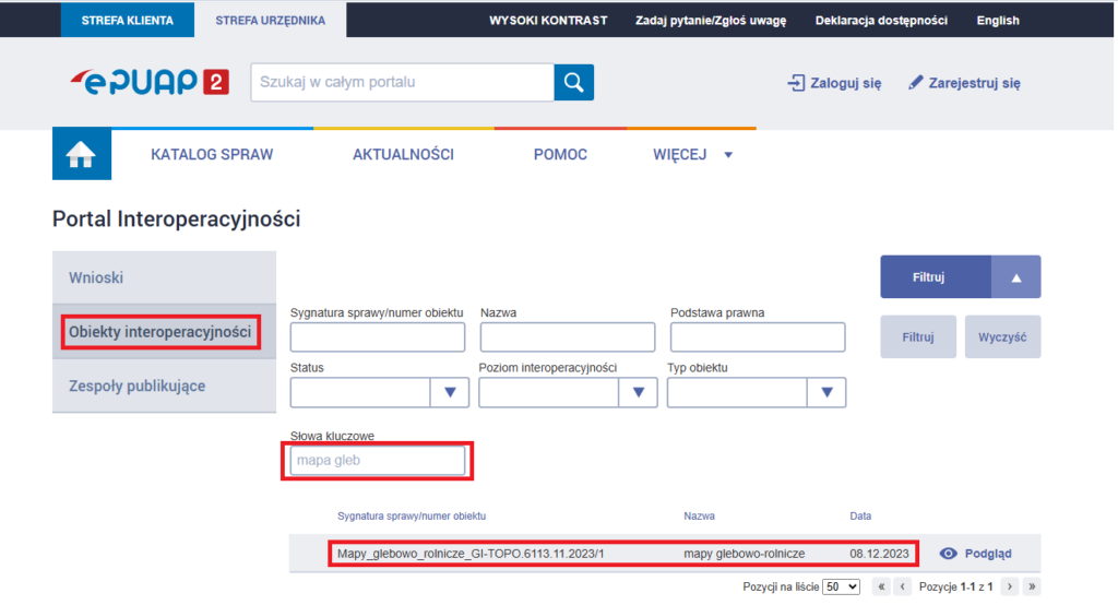
These data is provided in GML format compliant with the latest application schema available on the interoperability portal https://epuap.gov.pl/wps/portal/strefa-urzednika/inne-systemy/pi (all administration services are available in Polish only).
To easily search for an application schema, click the link above and select the “interoperability objects” service and enter Keywords in the filter panel, e.g. “soil map”. The given schema will be searched for (the case reference number and date may be different than in the figure below in the case of a model update).
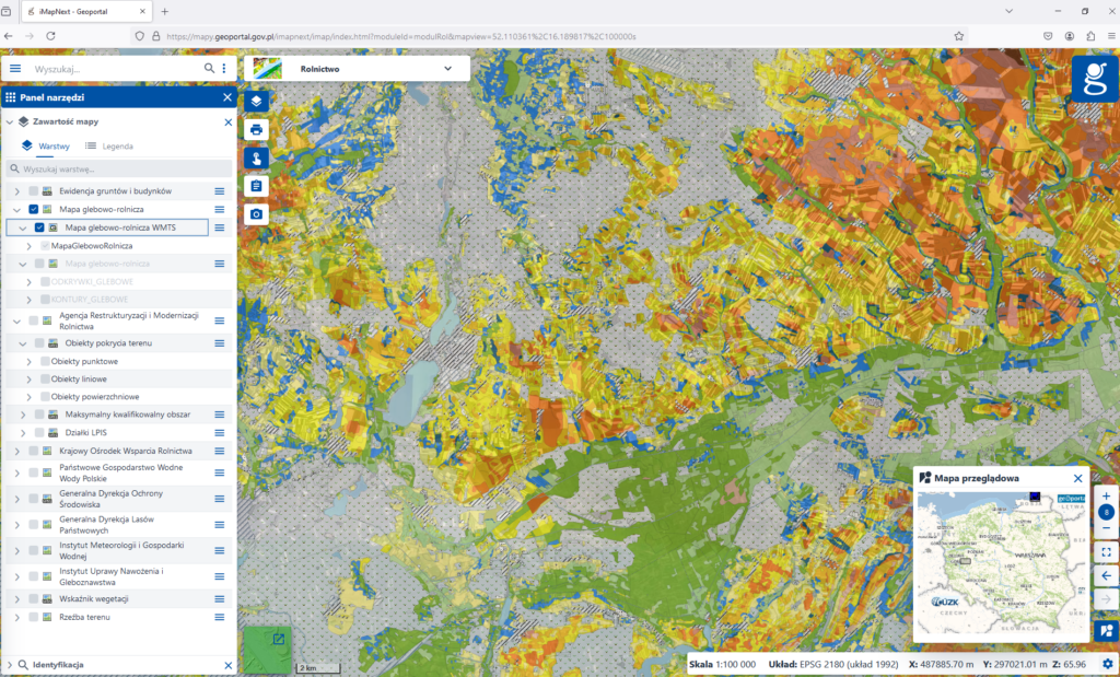
Vector soil and agricultural maps are also available for viewing in the following services:
- WMS (https://mapy.geoportal.gov.pl/wss/service/pub/guest/MapaGlebowoRolnicza/MapServer/WMSServer)
- WMTS (https://mapy.geoportal.gov.pl/wss/service/pub/guest/MapaGlebowoRolnicza/MapServer/WMTSServer).
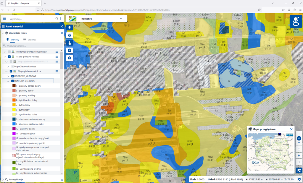
in the WMS service in the geoportal
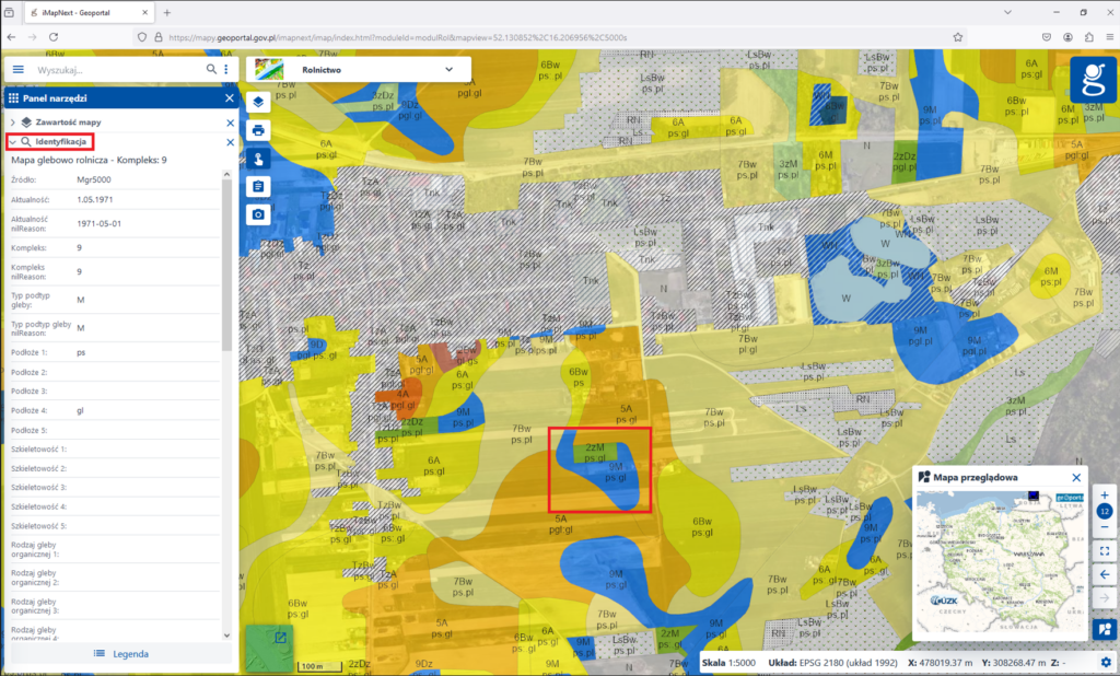
in the WMS service in the geoportal
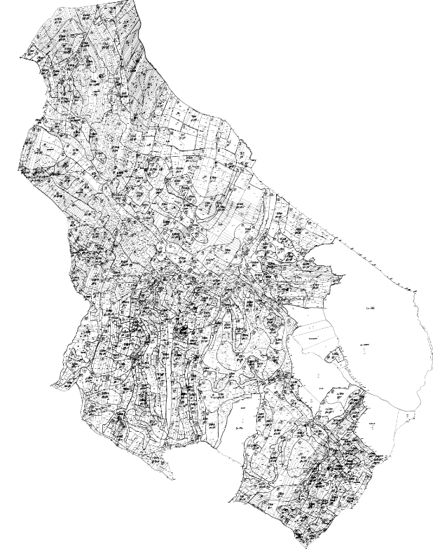
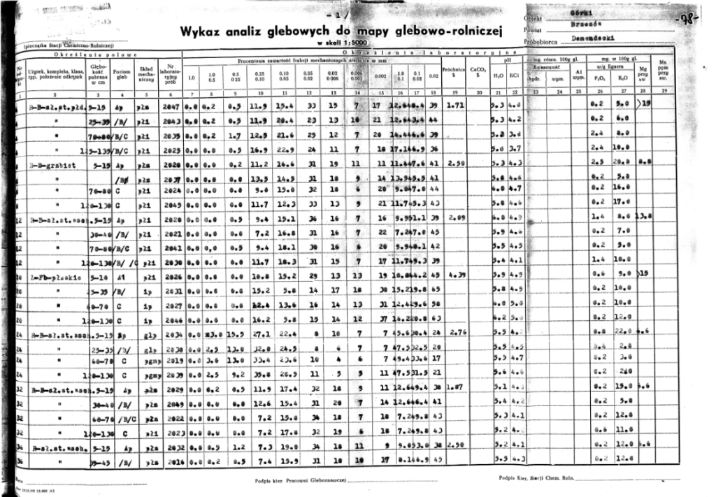
In addition, for some areas of the country, also raster format (tif), in digital form as map sheets scans (both uncalibrated and calibrated in the PL-1992 or PL-2000 coordinate system) available in NGCR. Additionally, soil analyses are available in tif or xls format for some voivodships.
Special maps
The „”Geographic Atlas of Poland” for the blind and visually impaired is a comprehensive elaboration intended for the blind that covers general geographic and thematic issues regarding the area of Poland. The atlas consists of 34 maps compiled in two volumes. The contents of the maps cover three thematic groups: the geographic environment of Poland (11 boards), socio-economic issues (19 boards), and Poland in the broader geographic and political context (4 boards).
The atlas has been compiled in two versions:
- digital – separately for two printing and relief embossing technologies of: swell paper and thermal forming (Fig. 9 and Fig. 10);
- printed (for thermal forming technology) (Fig. 11).
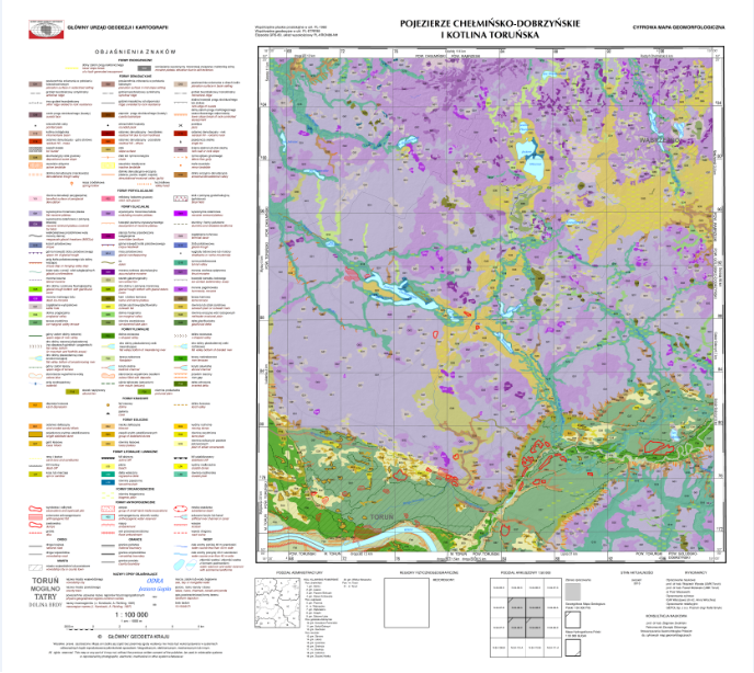
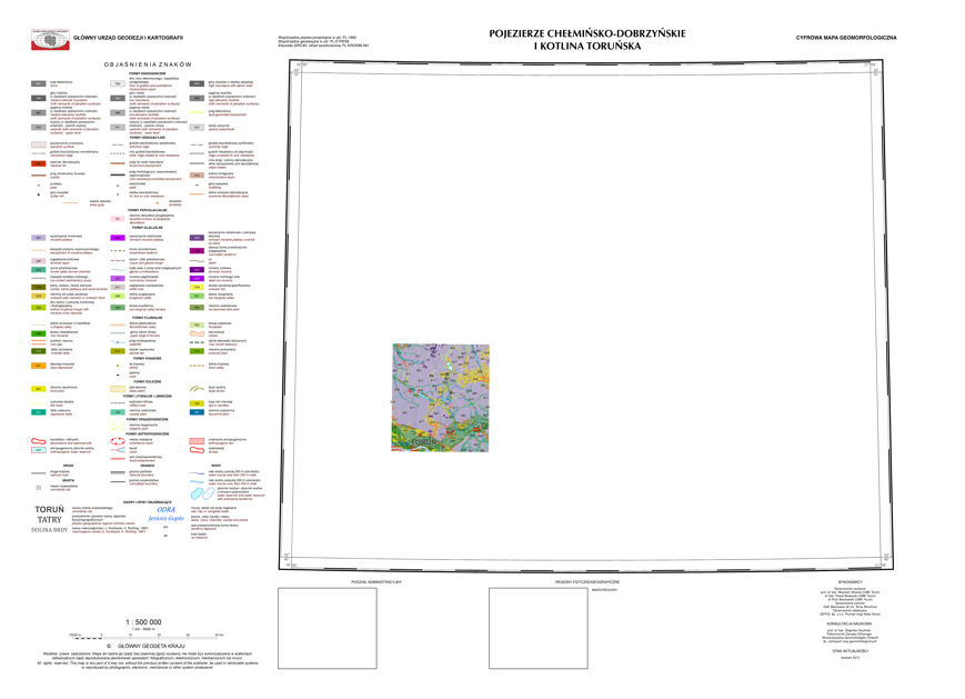
Treść tematyczna cyfrowej mapy geomorfologicznej Polski, w obu skalach, składa się z treści tematycznych oraz podkładowych. Treść tematyczną stanowią morfogenetyczne formy powierzchni ziemi i są to formy endogeniczne, denudacyjne, peryglacjalne, glacjalne, fluwialne, krasowe, eoliczne, litoralne i limniczne, organogeniczne oraz antropogeniczne.
Jako treść podkładowa zostały wykorzystane dane numerycznego modelu terenu, dane pochodzące z baz danych obiektów topograficznych, Państwowego Rejestru Granic oraz Państwowego Rejestru Nazw Geograficznych.
Mapy geomorfologiczne zgormadzone w centralnej części państwowego zasobu geodezyjnego i kartograficznego udostępniane są w postaci plików shp, gml (geometria z atrybutami), w postaci wektorowego obrazu kartograficznego w formacie lyr (dla każdego arkusza opracowany jest plik projektowy mxd z wizualizacja mapy) oraz w postaci rastrowej w formatach tiff, jpg oraz pdf.
Mapy specjalne
„Atlas geograficzny Polski” dla niewidomych i słabowidzących stanowi kompleksowe opracowanie tyflologiczne obejmujące zagadnienia ogólnogeograficzne i tematyczne z obszaru Polski.
Pierwsze wydanie (2004 r.) stanowi 25 plansz mapowych pogrupowanych w 3 bloki tematyczne:
– plansza podstawowa (granice kraju, wybrane miasta i rzeki);
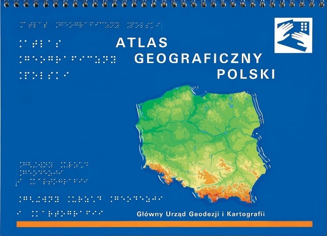
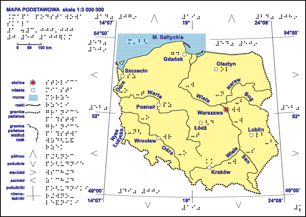
– dział I – ogólna charakterystyka środowiska przyrodniczego (7 plansz), obejmuje zagadnienia: krainy geograficzne, tektonika, utwory powierzchniowe, gleby, temperatury stycznia, temperatury lipca, opady atmosferyczne, okres wegetacyjny, wody, ochrona przyrody oraz degradacja środowiska;
– dział II – zagadnienia społeczno-gospodarcze (13 plansz), obejmuje: podział administracyjny, miasta, gęstość zaludnienia, użytkowanie ziemi, rolnictwo, wydobycie surowców, elektrownie
i rafinerie, huty metali, przemysł elektromaszynowy, przemysł chemiczny, przemysł włókienniczy, mineralny, spożywczy, drewno-papierniczy, ośrodki i okręgi przemysłowe, drogi, koleje i turystyka;
– dział III – kraj w szerszym kontekście geograficznym i politycznym (4 plansze), obejmuje tematy: Europa Środkowa, Polska przed i po II wojnie światowej, Morze Bałtyckie, Unia Europejska.
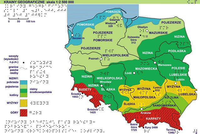
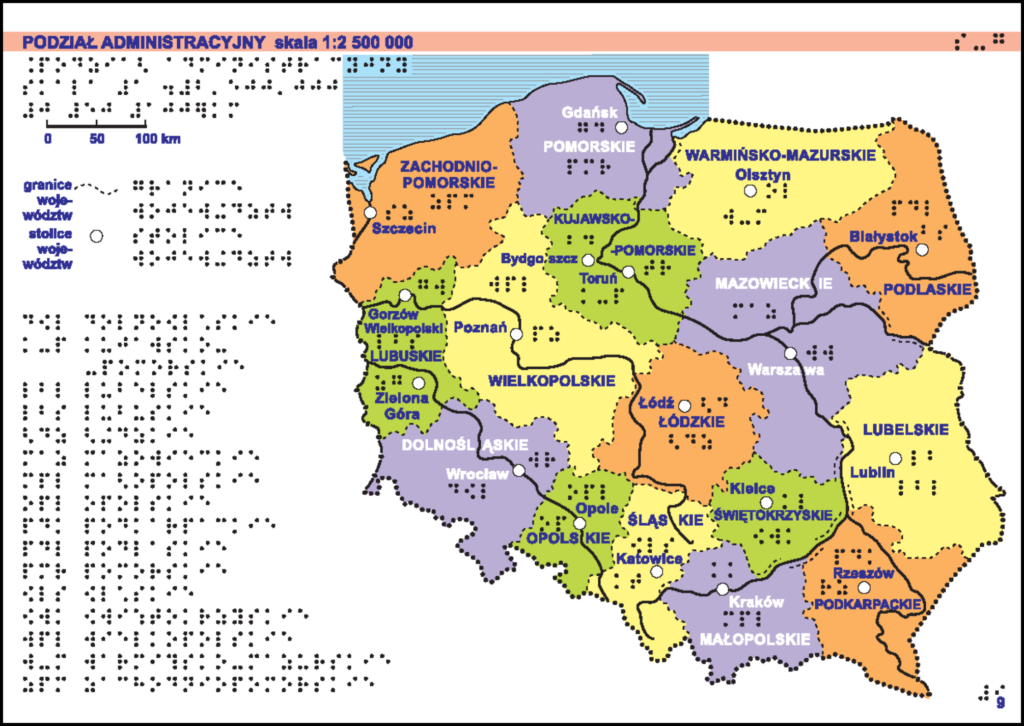
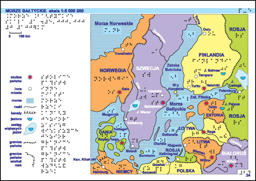
Atlas został wykonany w technologii papieru puchnącego (zwanego mikrokapsułkowym, pęczniejącym, eksplozyjnym) – wydruk mapy w drukarce laserowej z zastosowaniem pełnej kolorystyki (elementy, które mają zostać uwypuklone muszą być wykonane w odpowiednich parametrach czerni lub odcieniach szarości) i uwypuklenie (pod wpływem wysokiej temperatury) warstwy reliefowej w termouwypuklarce.
Nowe wydanie (2020 r.) atlasu zawiera 34 mapy skompletowane w II tomach. Treść map atlasu obejmuje trzy grupy tematyczne: środowisko geograficzne Polski (11 plansz), zagadnienia społeczno-ekonomiczne (19 plansz), Polska w szerszym kontekście geograficznym i politycznym (4 plansze).
Atlas opracowany został w dwóch wersjach wydawniczych:
- cyfrowej – oddzielnie dla dwóch technologii druku i tłoczenia reliefowego: papieru puchnącego oraz termoformowania (Rysunek 14,14a i 15,15a),
- drukowanej (w technologii termoforowania) (Rysunek 16,16a).
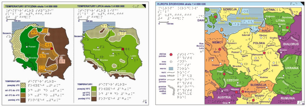
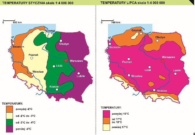
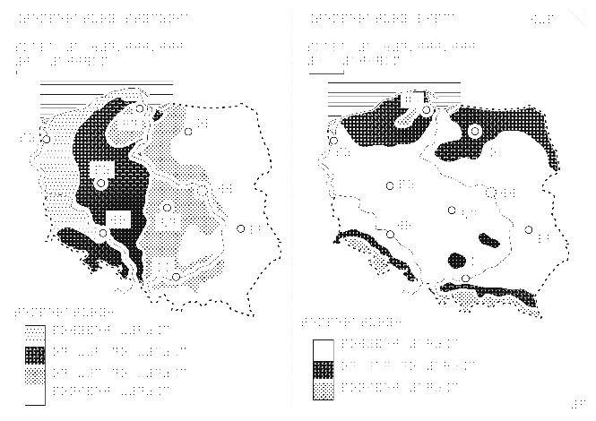
Rysunek 15,15a. Przykład map w wersji do druku i wytłoczenia w technologii termoformowania
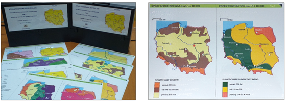
Pliki cyfrowe są udostępniane bezpłatnie zarówno w postaci wektorowej (pliki formatu CDR), jak i w postaci rastrowej (pliki formatu PDF, TIF oraz JPG).
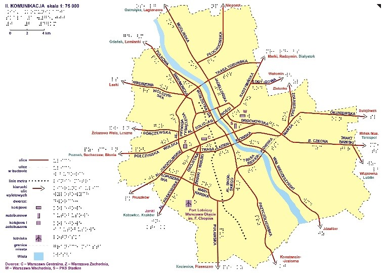
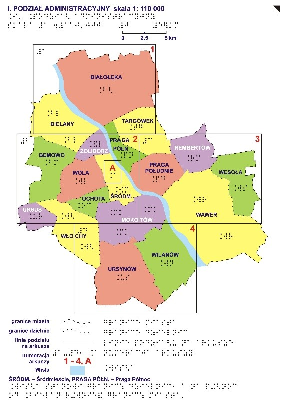
„Plan Warszawy” dla niewidomych i słabowidzących – atlas (opracowany w technologii druku na papierze puchnącym), który tworzy 8 plansz:
I – Podział administracyjny (granice poszczególnych dzielnic, zasięg poszczególnych arkuszy planu miasta);
II – Komunikacja (drogi krajowe i wojewódzkie na terenie Warszawy, będące ważnymi szlakami komunikacyjnymi w obrębie miasta, kierunki, do których prowadzą: miejscowości leżące w obrębie aglomeracji warszawskiej oraz inne duże miasta na terenie kraju, najważniejsze dworce (kolejowe i autobusowe), lotnisko, linia metra);
III – Legenda;
V-VII – Plan Warszawy w skali 1:25 000;
VIII – Centrum – fragment arkusza z centrum miasta powiększony do skali 1:10 000.
„Atlas geograficzny Europy” dla niewidomych i słabowidzących – (opracowany w technologii druku na papierze puchnącym) składa się łącznie z 46 plansz formatu A3 pogrupowanych w trzy działy tematyczne.
Dział I przedstawia położenie kontynentu europejskiego na kuli ziemskiej (plansze: siatka kartograficzna, mapa świata oraz mapa Europy z fragmentami sąsiadujących
z nią kontynentów).
Dział II przedstawia Europę w ujęciach tematycznych (map: ogólna kontynentu – z zaznaczoną linią brzegową, głównymi rzekami oraz siatką kartograficzną, ukształtowania terenu, hydrograficzna, podziału politycznego, osadnictwa).
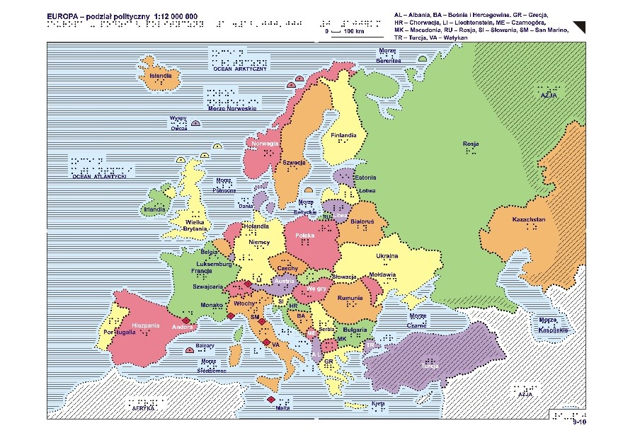
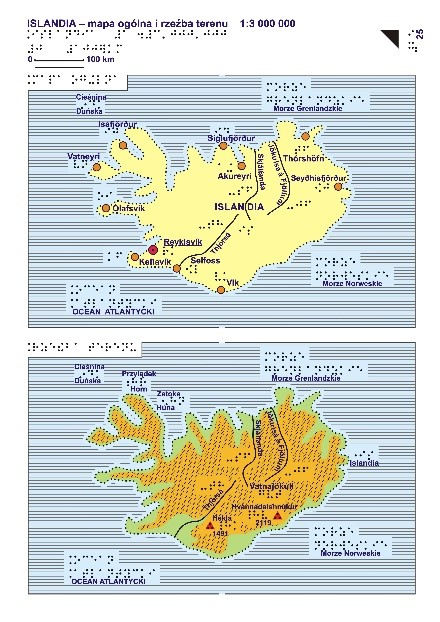
Dział III składa się z 35 plansz stanowiących przegląd 19 regionów Europy (większość jest pokazana na dwóch mapach: ogólnej, gdzie pokazane są rzeki, jeziora, główne miasta i krainy oraz rzeźby terenu, gdzie pokazane są obszary położone powyżej 200 m n.p.m., przebieg najważniejszych pasm górskich, najwyższe szczyty oraz elementy charakterystyczne dla geografii danego regionu, np. zespoły jezior, tereny bagienne czy urozmaicona linia brzegową).
„Atlas geograficzny świata” dla niewidomych i słabowidzących – ma postać luźnych plansz (formatu A3) przechowywanych w teczce. Atlas składa się 38 map podzielonych na dwie części tematyczne stanowiące tomy atlasu. Dodatkowo atlas opatrzony jest załącznikiem CD zawierającym opisy wszystkich map, metodykę ich czytania oraz inne informacje przydatne dla użytkowników.
Część pierwsza Atlasu jest poświęcona zagadnieniom przyrodniczym oraz społeczno-gospodarczym
1 plansz przedstawia problematykę społeczno-gospodarczą).
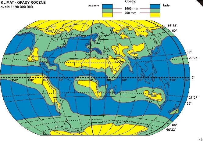
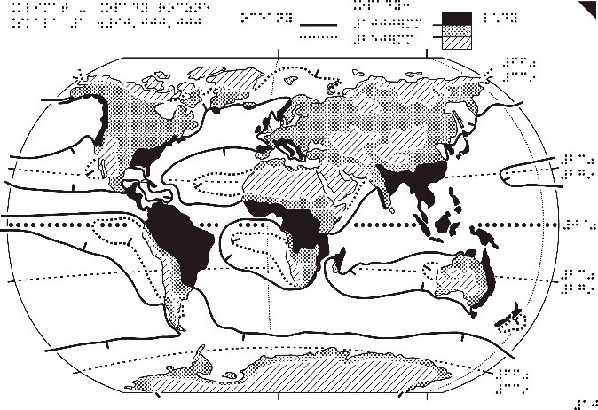
Rysunek 19,19a. Mapa Klimat – opady roczne z „Atlasu geograficznego świata” dla niewidomych i słabowidzących
Część druga to przegląd regionów – 15 map (w skalach od 1:10 000 000 do 1:40 000 000) przedstawiających rzeźbę terenu oraz podział polityczny kontynentów.
Dostępność usług przeglądania map
Mapy topograficzne, ogólnogeograficzne, tematyczne i specjalne (tyflologiczne) można przeglądać z wykorzystaniem usług WMS i WMTS, które standardowo podłączone są w serwisie www.geoportal.gov.pl. Usługi można także podłączyć w dowolnym oprogramowaniu, które potrafi takie standardy wykorzystywać (np. QGIS).
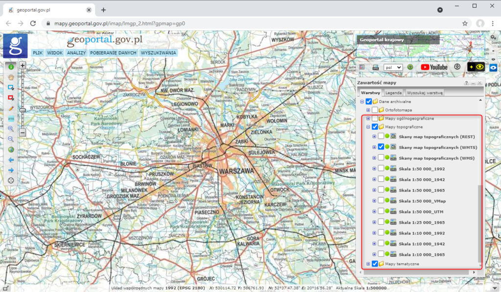
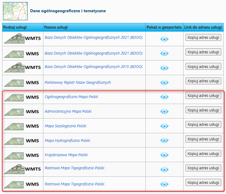
Informacje o wszystkich usługach prezentujących mapy topograficzne, ogólnogeograficzne, tematyczne i specjalne (tyflologiczne), prowadzonych przez Główny Urząd Geodezji i Kartografii można znaleźć w menu głównym serwisu www.geoportal.gov.pl w pozycji „Usługi/Usługi przeglądania WMS i WMTS” (Rysunek 21).
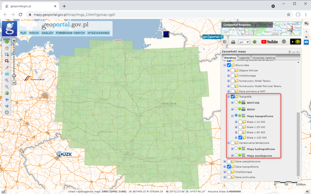
Szczegółowy zasięg dostępnych map topograficznych w danej skali i danym układzie można zweryfikować w serwisie https://www.geoportal.gov.pl/ w sekcji Skorowidze w grupie warstw Topografia -> Mapy topograficzne. Szczegółowy zasięg dostępnych map tematycznych można zweryfikować również w sekcji Skorowidze, w grupie warstw Opracowania tematyczne (Rysunek 22)
Udostępnianie map
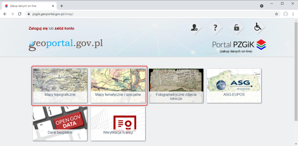
Udostępnianie map topograficznych, ogólnogeograficznych oraz tematycznych i specjalnych odbywa się na podstawie wniosku o udostępnienie materiałów państwowego zasobu geodezyjnego i kartograficznego lub poprzez PORTAL PZGiK
Mapy specjalne w postaci cyfrowej są dostępne bezpłatnie i możliwe do dowolnego wykorzystania. Pobieranie map specjalnych w postaci cyfrowej jest możliwe z serwisu www.geoportal.gov.pl, w którym w sekcji “Dane do pobrania” widoczna jest grupa warstwa “Topografia“, a tam z kolei warstwa “Opracowania tyflologiczne“. Po włączeniu wymienionej warstwy po kliknięciu w dowolnym obszarze Polski, będą dostępne do pobrania mapy tyflologiczne w formie cyfrowej (sitodruk, papier puchnący lub termoformowanie) (rys. 24).
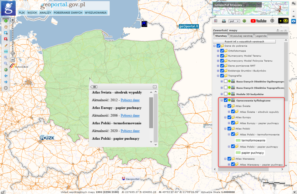
Elaborations intended for the blind at www.geoportal.gov.pl are downloaded via WMS, specifically via the GetFeatureInfo feature which shares a link to download the relevant map as an attribute in the clicked location.
